MY FAVORITE SPOTS
IN MEXICO

WHY GOING TO MEXICO TO PADDLE BOARD ?
The water is warm all year around: between 26°C and 30°C
Pacific side, Gulf of Mexico, lakes, lots of choices
To navigate in the jungle
To see the large des grands pélicans bruns, des frégates et bien d’autres

Lago Chapala
The biggest lake in Mexico
Isla de Mezcala
A 3 hours loop
Average difficulty
Info & Itinerary
On Lake Chapala, the largest lake in Mexico, Isla de Mezcala is full of history.
El Lago de Chapala, at 1500 meters above sea level, is the third largest lake in Latin America and the largest in Mexico with an area of 1,100 km² (about twice the size of Lake Geneva which is the largest lake in Europe). 80 km long by 20 km wide but its depth does not exceed 10 meters.
Distance – itinerary – LAUNCHING
A little less than 5 km separates the Isla de Mezcala from the village of Mezcala, it takes about 50 minutes of paddle.
Note: Variable of course depending on your physical condition and your experience in SUP as well as the wind direction.
My tip: Launching from the pier in the small village of Mezcala.
Then head towards the west of the island (the right point) to dock. A small pontoon allows easy access to the shore of the island.
What to see and what to do?
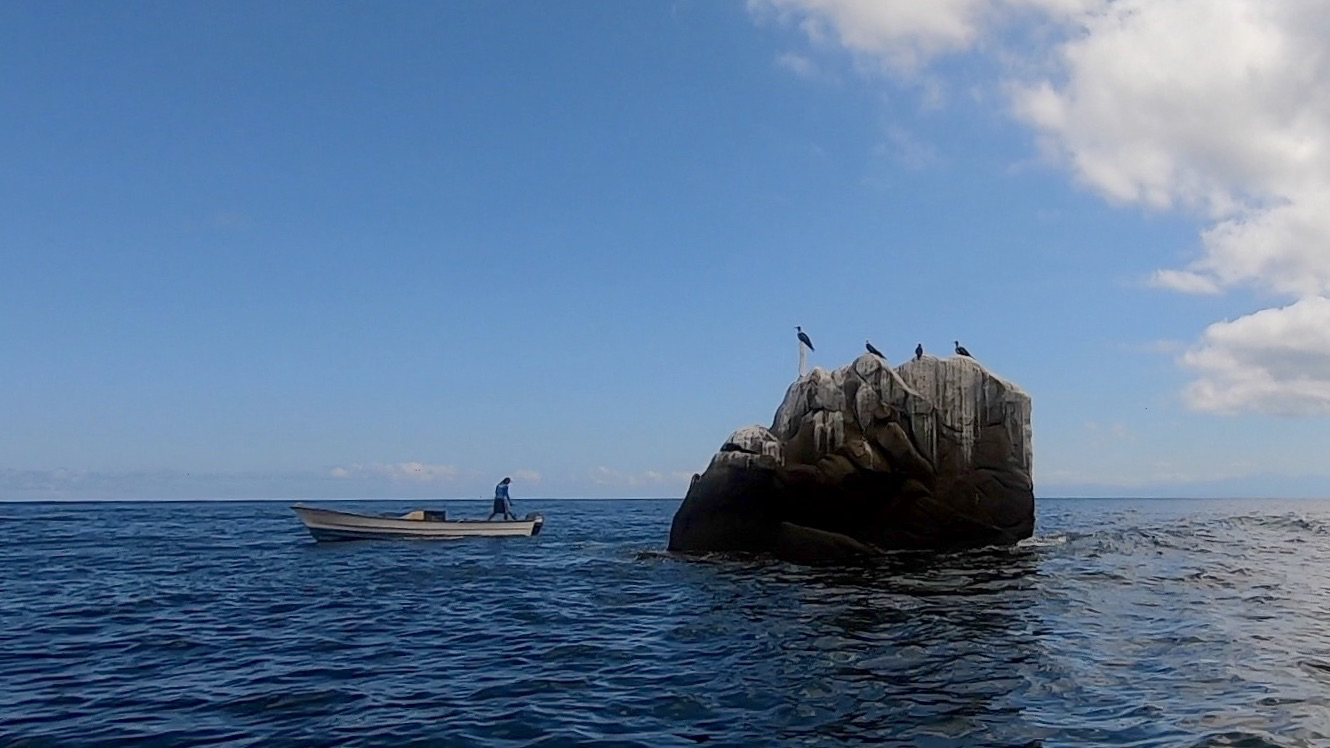
Along the way, you will be accompanied by large brown pelicans and herons.
The water of the lake isn’t very clear because the rivers of the surroundings carry a lot of earth.
When you arrive at the small boat landing, take the path in front of you which rises slightly.
On the left, you will see a tree with an unusual appearance, with its large white trunk and its apparent roots like tentacles, clinging to the rock.
You will then pass a large field of chayotes. Chayotes are very common in Mexico (they are also called “chouchou” or “christophine” in Reunion Island and the West Indies). They have the shape of a big pear, with a white or light green skin. In terms of taste, I would say that it is between zucchini and potato.
Then on your right stands the ruins of an old chapel built in volcanic stone. A spiral staircase leads to the roof and offers a panoramic view of the village of Mezcala and the surrounding mountains.
Continue your walk to arrive in front of the surrounding wall of an imposing fort that was the scene of long and bloody battles during the Mexican War of Independence against Spain from 1812 to 1816.
From the top of the wall, you can see the strategic position occupied by this fort.
After this historic walk, it is time to take your paddles. To leave, it is nice to go around the island, you will certainly meet some fishermen.

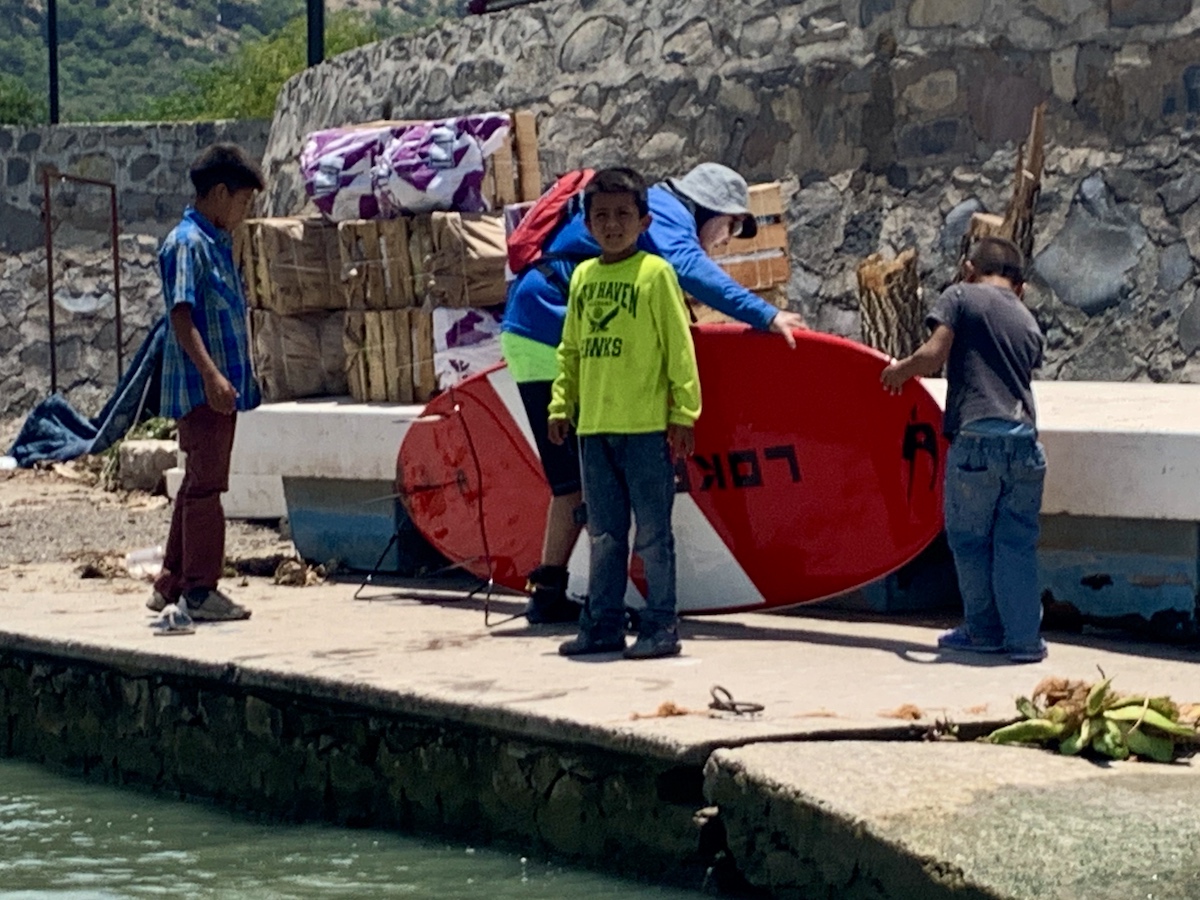
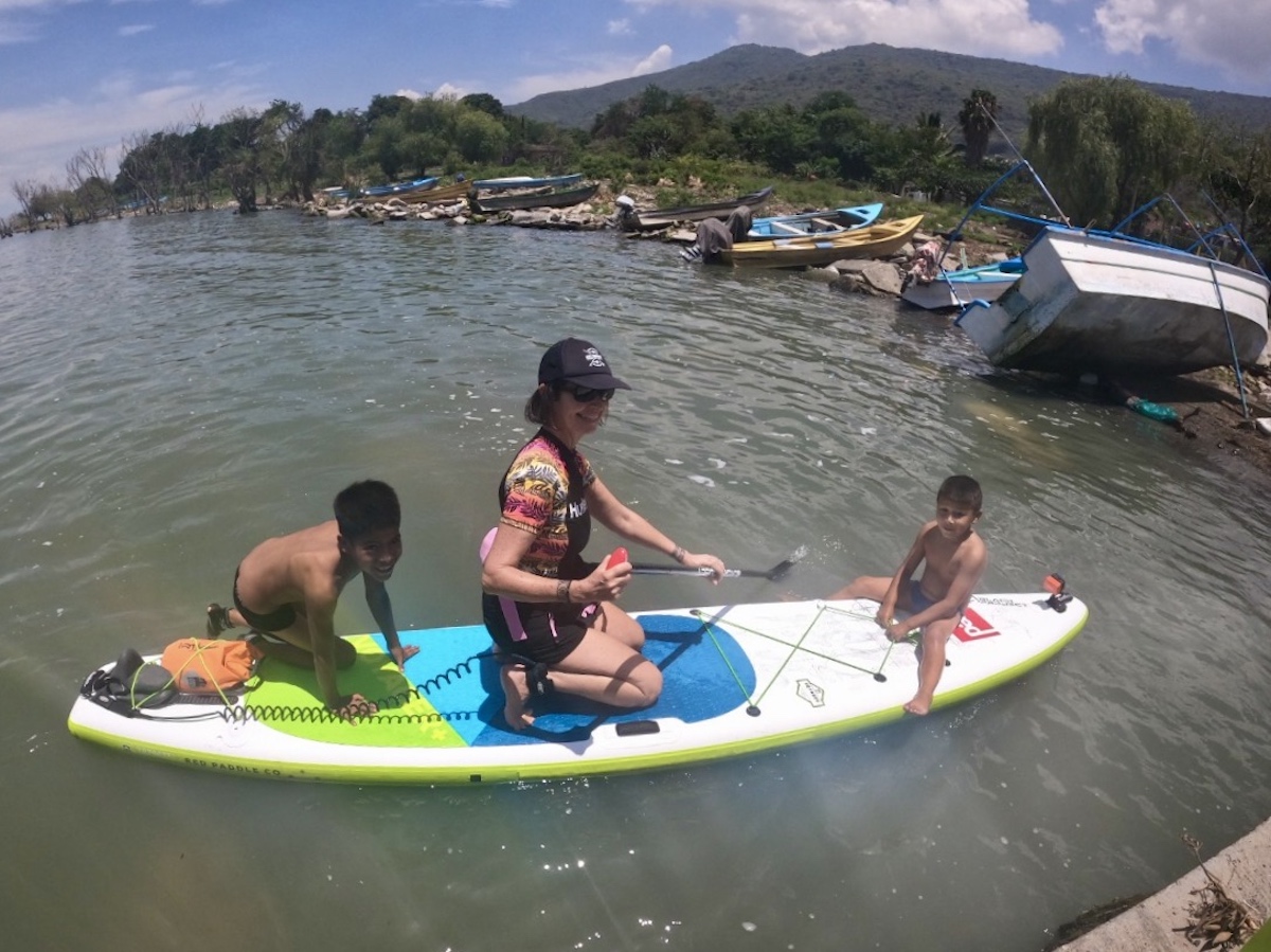
For this adventure, I had contacted Diego via my Facebook paddle network. Diego lives in Guadalajara, he’s a fan of surfing and SUP.
When we put the boards in the water, the weather was stormy but a light refreshing breeze made the crossing to Isla de Mezcala very pleasant. We crossed a lot of birds, they looked like great white herons. We also met some fishermen.
On the way back, we were greeted by three little guys from the village. The boldest of the group took off his pants and threw his t-shirt to join me on the paddle. I then let them both have fun with the board.
Program
- Start from the little village of Mezcala
- Around 50 minutes to 1 hour of paddleboard to arrive to the boat landing. Then, to go back if you go around the island it takes aproximatly 1h15
- Explore the Island of Mezcala and the old fort from colonial time.
Best time
Best time
- early morning
Generally the lake is calm in the morning and becomes windier and restless in the afternoon.
I invite you to always check the weather conditions before leaving because the wind can blow very strong on the lake.
Getting there
Mezcala, a small village on the shores of Lake Chapala, is just across from the Isla de Mezcala.
About 35 minutes drive from Chapala.
At the exit of Chapala, take the road 104 – Carretera Mezcala – San Pedro Itzican, which runs along the lake for 19km. When you arrive in the village, turn right on Calle Benito Juarez and then left on Calle Independencia, going down it to the end.
Park on the right next to the pier. Parking is free.
What you should bring?
- Drink and snacks
- Sunscreen and a lycra to protect you as the sun is very stong due to the altitude of 1500m
- Flip-flops or sneakers to walk around the island
Nota
No restroom


It feel like a sea
So large that we can’t see the other side!
Los Arcos
From Mismaloya
Bahia de Banderas
Around 2 hours
Beginner if with someone else or average
Info & Itinerary
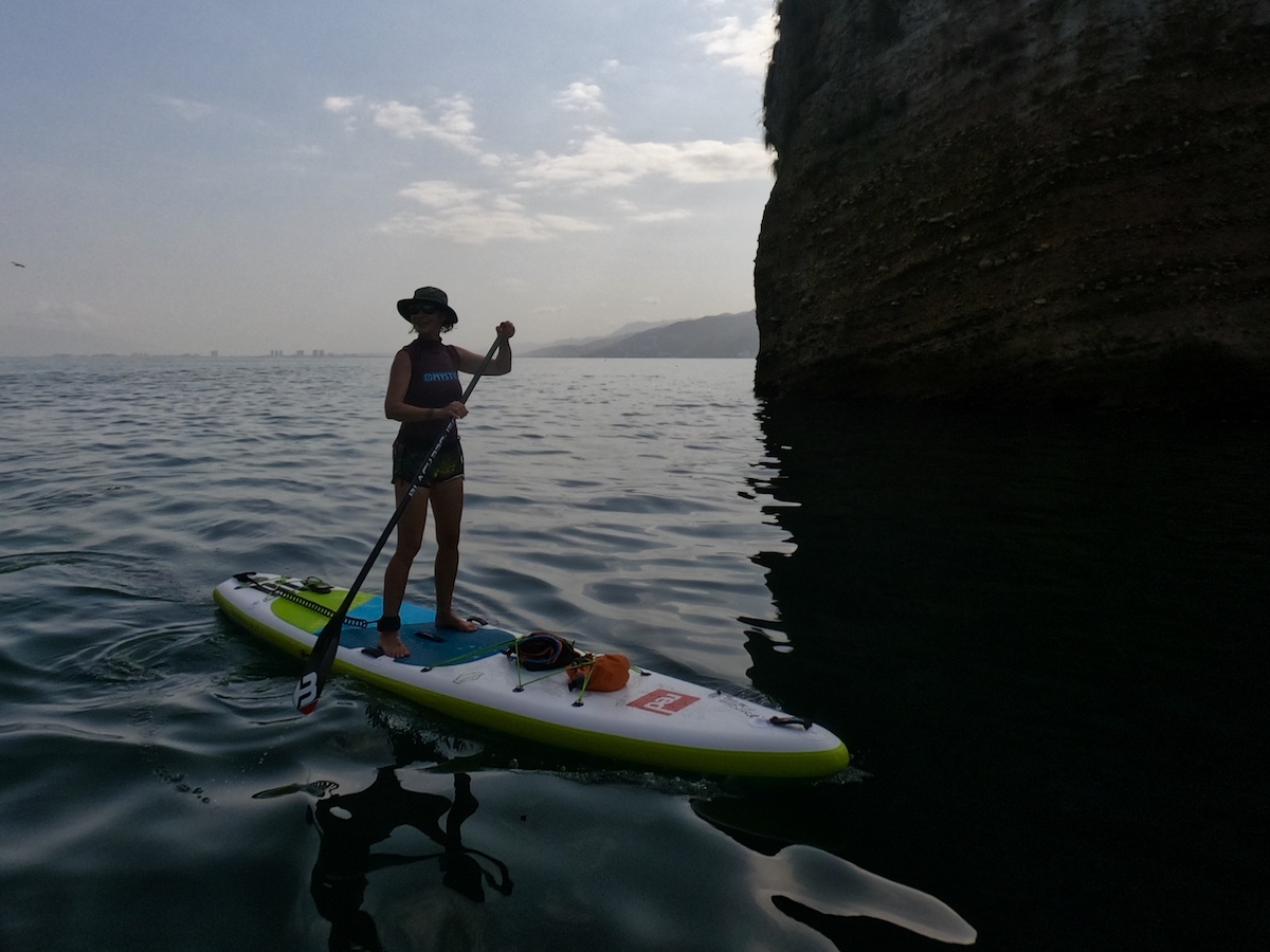
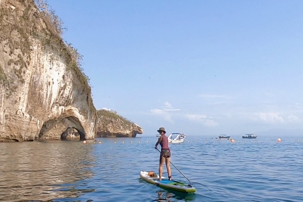
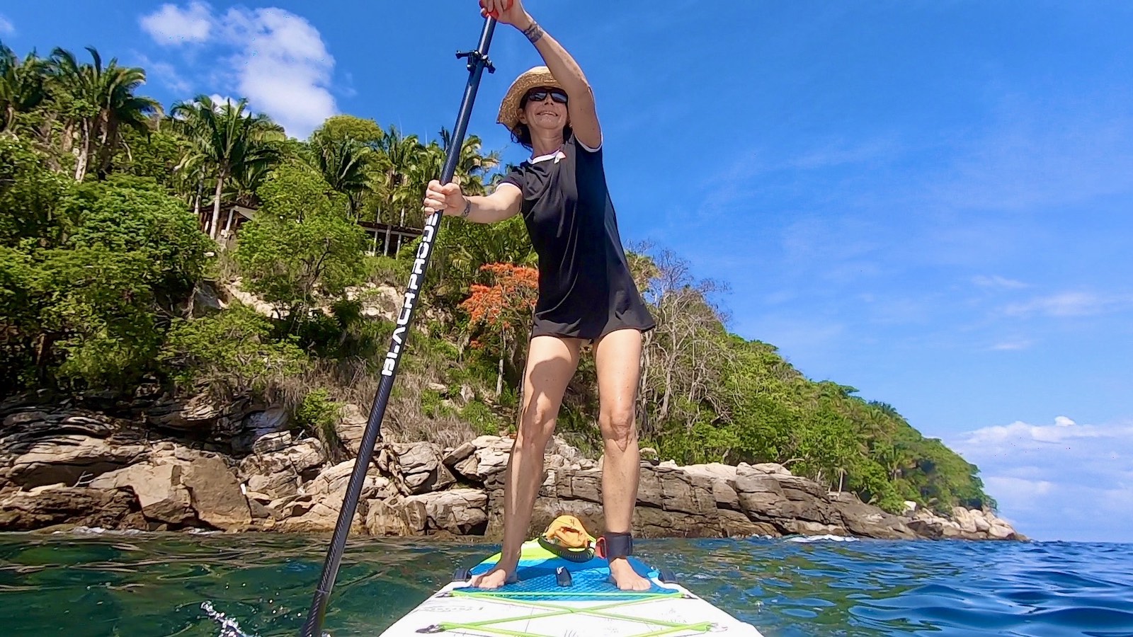
Los Arcos : in the middle of the emerald water, these 4 islets form a real paradise for birds.
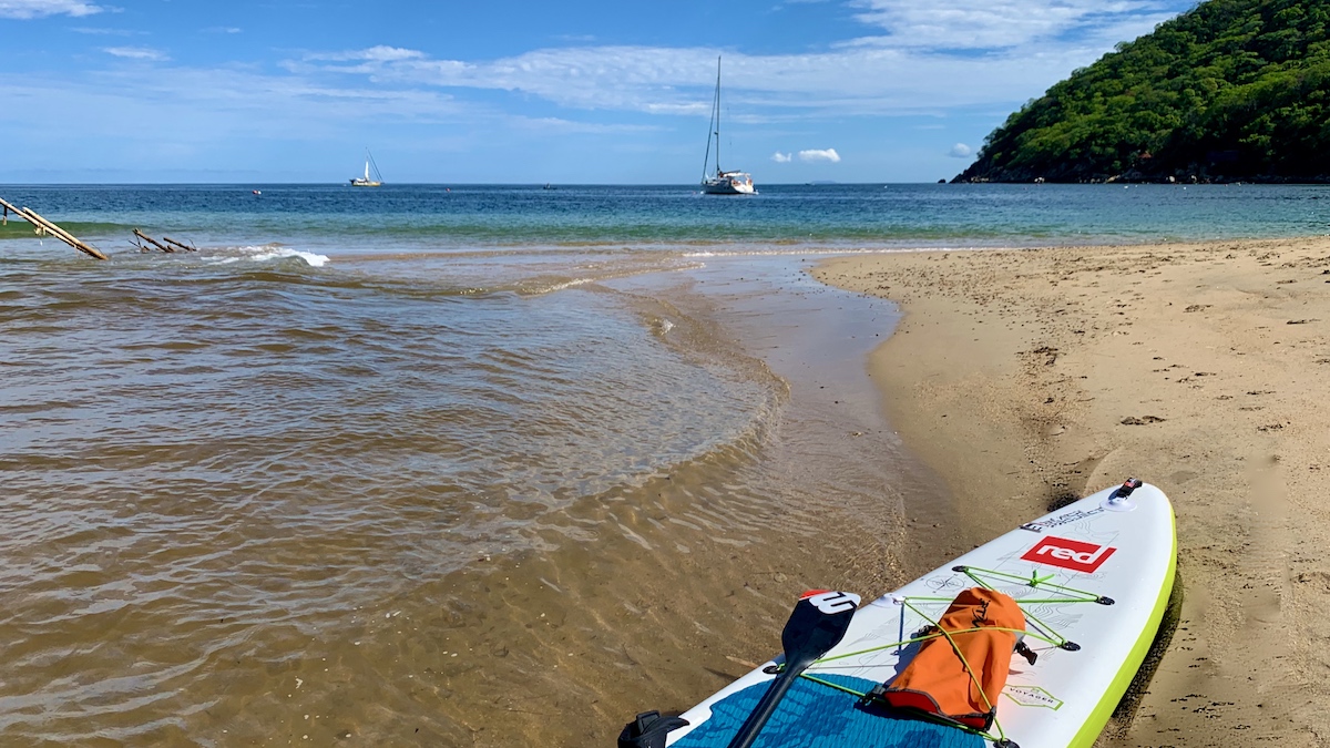
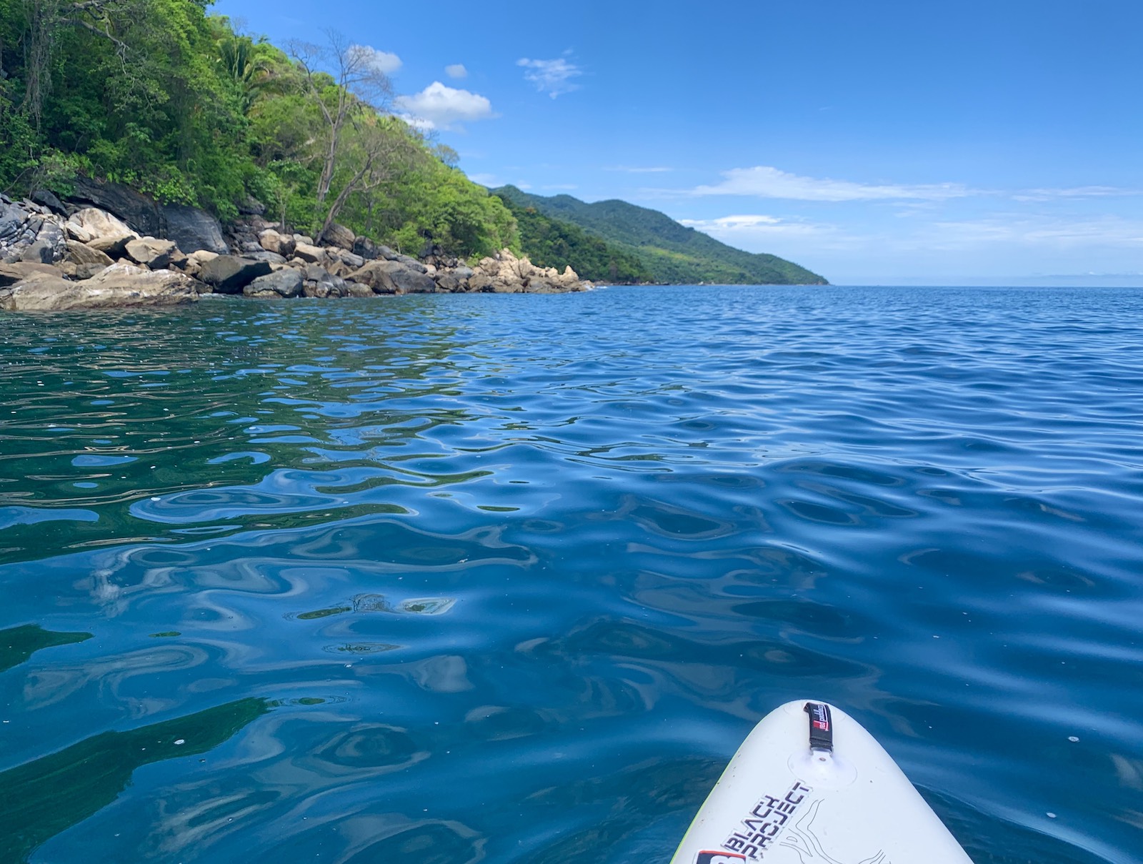
The small creek of Mismaloya is surrounded by jungle. This beautiful beach with soft and clear waters is a perfect spot for SUP and scuba diving.
Mismaloya was the location for the filming of “The Night of the Iguana”, a John Huston movie. Richard Burton introduced Puerto Vallarta to the world of gringos. The old set of the film is in ruins just south of the beach.
Distance – itinerary – Launching
Launching is very easy, starting from the beach of Mismaloya. Paddle slightly to the north towards the islets. The paddle trip to Los Arcos is quite short.
What to see & what to do?
Beaten by winds and waves these granite formations gush out at a height varying from 8m to 27m. The 3 main islets are called “Roca de Los Arcos” (Rock of the Arcos), “Roca de la Tortuga” (Turtle Rock) and “Roca del Diablo” (Devil’s Rock). The waters around the islets are the deepest in the bay. We are at the beginning of the famous San Andreas Fault, locally called the “Devil’s mouth” because the bottom descends to more than 500 m. It’s a real aquarium, you can see rays, fluorescent fish and lots of turtles. These islets are also a paradise for birds that can quietly nest at the top.

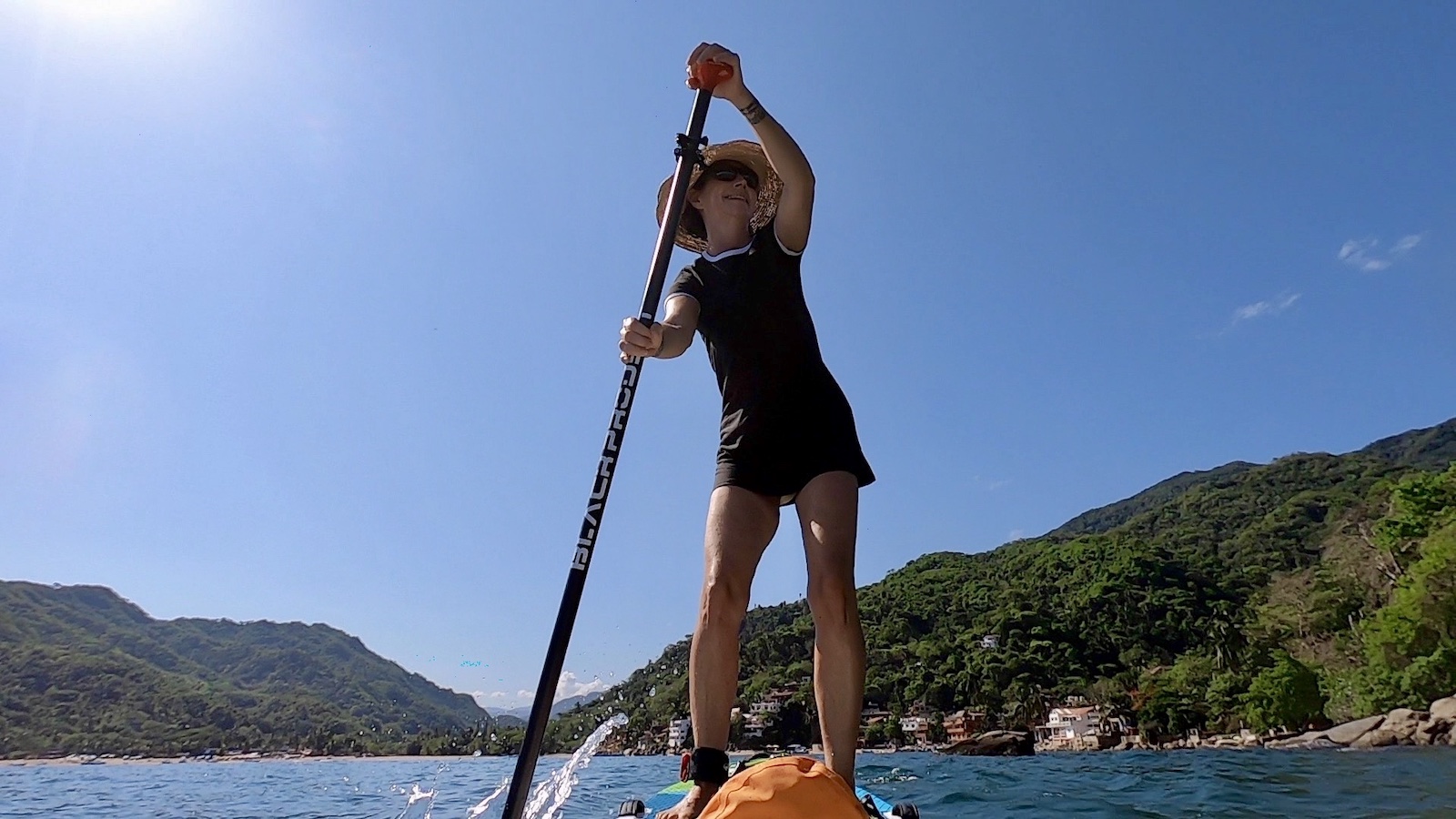
For this ballad, I had contacted Diego (a friend of the previous Diego). Diego loves to be on the water as well as underwater. He accompanies the tourists diving in the bay.
On the way back, he surprised me with a fresh coconut. 
Program
- Start from Mismloya cove
- Around 15/20 minutes by SUP to get to Los Arcos
- Paddleboard under the arches
Best time
The best moment to explore Los Arcos is in the early morning, you’ll be in complete tranquility.
It’s a very popular place. At the end of the morning, the place is taken by storm by charter boats landing a crowd of tourists armed with masks and snorkels.
I invite you to always check the weather conditions before leaving.
Getting there
Direction Mismaloya, on highway 200 about 30 minutes drive south of Puerto Vallarta.
Park your car on the parking lot along the river. Parking is free, just tip.
Address : Mismaloya Playa
What you should bring?
- Drinks
- Some snack (I brought some dried bananas bought on the market)
- Sunscreen and a lycra
- Mask and snorkel
Nota
No restroom


Yelapa
An amazing bay in the jungle
Bahia de Banderas
1 to 2 hours or more
Average or beginner
Infos & Itinéraire
Yelapa is only accessible by sea. You will take 45 minutes by water cab from Puerto Vallarta to reach Yelapa.
The bay is lined with green hills overlooking a blond beach fringed with palm trees. About twenty colorful pangas (traditional boat) are at anchor tossed by the swell. The village extends towards the heights. In the sky, one can admire the ball of frigates and pelicans.
Launching
Launching is very easy from Yelapa beach.
to do & to see
I suggest 2 itineraries:
- Paddleboard the west side (to the left) :
Go along the small port of Yelapa by paddle. You will cross pangas (traditional boats) and fishermen who greet you. Then pass the quay which is the real heart of the village and continue along the houses along the bay.
We leave the very protected part of the bay of Yelapa to go along the coast of the Baya de Banderas. The swell is felt more.
You will be able to admire the surrounding jungle which is reflected in the ocean and gives it this emerald green color. With a little luck you will see turtles. - Paddle board toward east (to the right): Go along the beach by paddle, past restaurants and palm-roofed bungalows.
On the big rocks you will see many pelicans and can admire their fishing technique.
Continue along the small creeks cut and beaten by the waves. Beware the swell can be quite strong.
Nota: I advise you not to cross Yelapa Bay. Indeed the traffic of boats is rather important, shuttles coming from Puerto Vallarta and fishing boats sail motor at full speed.
Programme
- Départ de la petite plage de Yelapa
- Durée en fonction des envies
- Naviguer le long de la baie et observer les immenses pélicans sur les rochers
Quand y aller ?
- Tout au long de la journée
Je vous invite à toujours vérifier les conditions météo avant de partir
Comment y aller ?
Prendre une des nombreuses navette au départ du ponton principal de la plage de Puerto Vallarta.
Vous pouvez soit sejourner à Yelapa,
Vous pouvez venir à Yelapa pour la journée, prendre la navette le matin, paddle le long de la baie, faire une pause dejeuner dans l’un des restaurants de la plage, farniente sous les parasols
Adresse : Playa Yelapa
Quoi emporter ?
- À boire
- Crème solaire indispensable et un lycra
- Maillot de bain
Nota


Let’s look at the large brown pelicans
Perched on a rock , they are always hunting for fish.
